
Quick facts
| Region | Langtang National Park |
| Our itinerary | 10 days, with 6 walking days |
| Highest sleep | Kyanjin Gompa, about 3,870 m |
| Optional viewpoints | Kyanjin Ri about 4,773 m, Tserko Ri about 4,984 m |
| Our rating | Moderate |
| Permit | Langtang National Park |
Viewpoint heights vary between sources, so treat them as approximate.
The route, day by day
| Day | Route | Sleep at | Walking |
|---|---|---|---|
| 1 | Arrive in Kathmandu | 1,400 m | None |
| 2 | Drive to Syabrubesi | 1,460 m | None |
| 3 | Trek to Lama Hotel | 2,470 m | About 6 hours |
| 4 | Trek to Langtang village | 3,430 m | About 6 hours |
| 5 | Trek to Kyanjin Gompa | 3,870 m | About 3 hours |
| 6 | Hike Kyanjin Ri or Tserko Ri | 3,870 m | About 6 hours |
| 7 | Trek to Lama Hotel | 2,470 m | About 6 hours |
| 8 | Trek to Syabrubesi | 1,460 m | About 5 hours |
| 9 | Drive to Kathmandu | 1,400 m | None |
| 10 | Departure | None | None |
What it's like
You begin by walking through oak, rhododendron and bamboo beside the Langtang Khola, where you may spot monkeys. The red panda also lives in this park, although seeing one is rare. Past Ghodatabela, the forest opens into yak pastures, and the valley feels vast. At Kyanjin Gompa, you'll find an old monastery, a cheese factory and a ring of high peaks and glaciers.
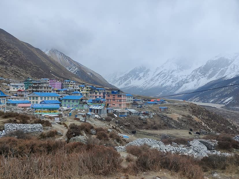
Langtang after the 2015 earthquake
The earthquake of April 2015 caused a huge landslide and ice avalanche that destroyed Langtang village. Reports say about 300 people died there, including visitors. A stone memorial stupa now stands near the rebuilt village. Trails and guesthouses have been repaired, and even the cheese factory at Kyanjin Gompa has been rebuilt. Please walk through this place with respect, and remember that many families lost loved ones.
A 2025 Al Jazeera report described the valley as a "reluctant tourist hotspot," and it notes the complicated feelings of residents about tourism and recovery. Staying in family-run lodges and buying locally helps your money stay in the valley.
Wildlife and the park
Langtang National Park includes forests that are a habitat for the endangered red panda. One 2021 study estimated about 214 km² of potential red panda habitat in the park, and it also found that some of the landslides triggered by the earthquake had hit this core habitat. Sightings are unusual, so don't expect to see one. Keep your voice low in the forest, stay on the trail, and ask your guide what to look out for.
Walking through the village today
The new settlement sits above the site of the old one, and residents did much of the rebuilding themselves when government aid was slow to arrive. The earthquake memorial is a clear reminder of what happened here. Ask before photographing people, and keep your voice down around the memorial and the old village site. Your guide can tell you how to be respectful, and many residents will have their own stories, which they may or may not want to share.
How hard is it?
It's moderate. The climb from Syabrubesi is steady, and days are fairly long, but the route doesn't cross a high pass. Kyanjin Ri is a stiff climb at altitude, while Tserko Ri is longer and tougher, so only try it if you're fit and well. Height gain is significant between Lama Hotel and Langtang, so walk slowly. See our altitude sickness guide.
Getting there
The drive to Syabrubesi takes much of a day on a rough mountain road. The UK government warns that road accidents are a major risk in Nepal, particularly in the monsoon and in mountain areas, and it advises against night travel and overcrowded buses. A private jeep or reputable vehicle costs more but is worth considering. Landslides can also close the road, so allow spare time.
Permits and guides
You'll need a Langtang National Park permit, widely reported at NPR 3,000 for foreign visitors. Reports differ on TIMS. See our permit guide and guide rules.
When to go
- Spring: warmer days, with rhododendrons in the forest.
- Autumn: clear views and comfortable temperatures. It's a popular time.
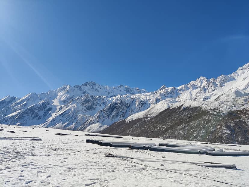
- Winter: quieter and cold, with snow higher up. Check that lodges are open.
- Monsoon: rain, leeches and landslide risk make it a poor choice.
Extend your trek
| Option | Why |
|---|---|
| Langtang and Gosaikunda | Add sacred alpine lakes and Laurebina Pass |
| Tamang Heritage Trail | Add village culture and hot springs |
| Yala Peak | A good first climb from Kyanjin Gompa |
What to pack
- Layers for forest warmth and cold evenings at Kyanjin
- A warm sleeping bag
- Trekking poles and well-worn boots
- Sun protection and a warm hat
- Water purification tablets or a filter
- Enough rupees from Kathmandu
Common questions
Can I do it in less time?
Some trips run to about 7 or 8 days. You could shorten our plan, but keep the day at Kyanjin Gompa. It's the highlight, and it helps you adapt.
Is Langtang safe now?
Trails have been repaired, but the area remains prone to landslides and earthquakes. Listen to your guide, and check conditions before you go.
How does it compare with Annapurna or Everest?
It's shorter, cheaper to reach and generally quieter than the most famous routes. The peaks are lower, but they're still extremely impressive.
Next steps
See the Langtang Valley Trek page, compare other treks from Kathmandu, or ask us about dates.


Comments